Pati Valley: the complete guide
What it is, how long it takes, where you sleep and what it costs to walk the finest trek in Brazil.
Last updated 9 September 2026
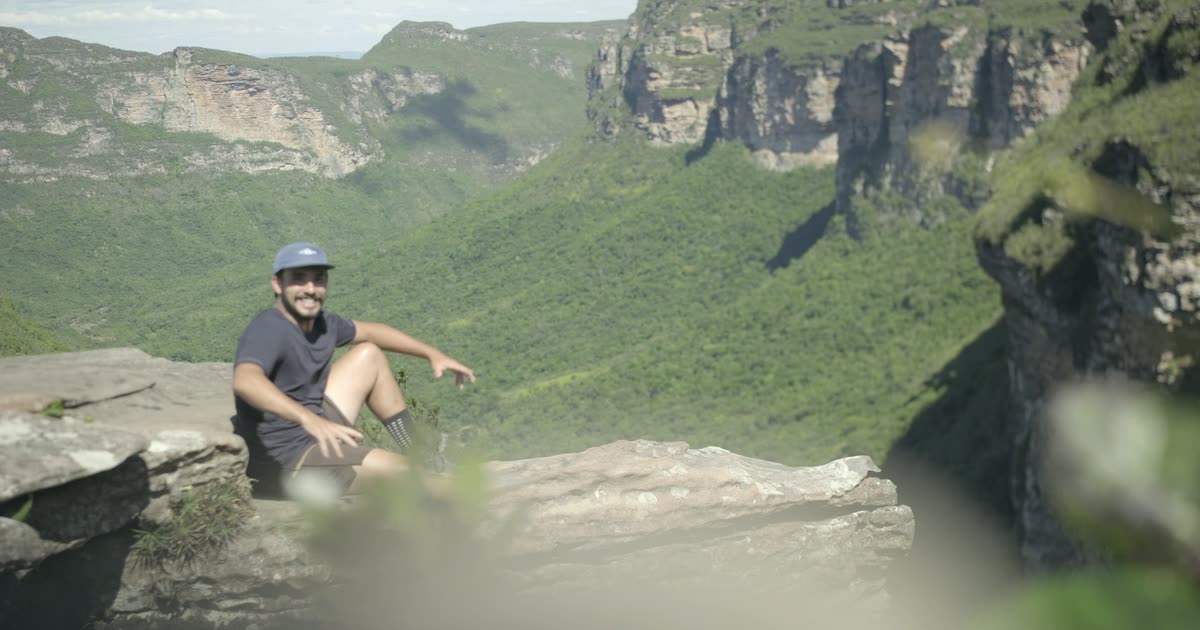
Pati Valley is an inhabited valley inside Chapada Diamantina National Park, in Bahia, Brazil. The crossing takes 3 to 6 days on foot, sleeping in the homes of the families who live there. There is no road, no hotel and no mobile signal, which is exactly why the place is still what it is.
What Pati Valley is
Two hundred years ago this was diamond mining and smallholding country. The mining ended, most families left, and the ones who stayed began hosting the people who came to walk. That is what it is now: a handful of houses scattered through a valley ringed by cliffs, with no road reaching them.
The valley sits inside Chapada Diamantina National Park, in the municipality of Andarai, with access from Palmeiras, from Vale do Capao and from Andarai. You walk in and you walk out. Everything consumed in there was carried on someone’s back or by mule.
How many days it takes
Three to six. The choice changes what you see, and the difference between routes is not only effort:
| Route | Distance | Difficulty | Max. altitude | Per person |
|---|---|---|---|---|
| 3 days | 40 km | Moderate | 1,180 m | US$ 460 |
| 4 days | 50 km | Intermediate | 1,200 m | US$ 560 |
| 5 days | 68 km | Challenging | 1,250 m | US$ 650 |
| 6 days | 80 km | Challenging | 1,280 m | US$ 690 |
- 3 days covers the Pati Viewpoint, Castelo Hill and the Fenda da Prefeitura. The format for a short trip that still takes in the landmarks.
- 4 days adds a free day, where you choose between an easier route past Poço da Árvore and the river junction, or a harder one to the Palmito and Calixto waterfalls.
- 5 days is the only route that descends to the base of Cachoeirao, inside the canyon. If you have seen it from above and want it from below, this is the one.
- 6 days is the full crossing, 90 km, entering through the Gerais do Rio Preto and leaving via the Ladeira do Império towards Vale do Capao.
What you see along the way
Pati Viewpoint
The first big frame of the trek, just after the climb from Aleixo. It is where the scale of the valley lands.
Castelo Hill
The climb runs through a quartzite cave before the summit. The view from up there is the most recognisable image in the whole Chapada. It is on every route.
Cachoeirao
The valley’s biggest waterfall, inside a canyon. You can see it from above, at the viewpoints and the rim, and from below by reaching the base. In the wet season dozens of separate threads of water come off the wall at once.
The valley waterfalls
Altina, Funis, Bananeiras, Palmito and Calixto, plus Poço da Árvore and the river junction. Most days end with a swim in one of them.
Fenda da Prefeitura and Ladeira do Império
The Fenda is the way out of the valley over the top, with viewpoints on the rim of Cachoeirao. The Ladeira do Império is a climb on nineteenth century stone paving, laid by hand when this was a mule drivers’ route.
Where you sleep
In the homes of the valley families. A different house each night, eating what the house cooks on the wood stove, with the family.
The houses provide a bed, a blanket and a bath towel. No sleeping bag, no mat, no towel, which makes the pack far smaller than on a camping crossing. On our routes accommodation and full board are already in the price.
This is what keeps tourism money with the people who live in the valley, instead of it leaving for a hotel chain. It is not a detail of the itinerary: it is the reason the valley is still inhabited.
Difficulty and fitness
Between 8 and 17 km a day, on uneven ground, with long climbs, loose rock, slabs and river crossings. The high point sits between 1,180 m and 1,280 m depending on the route, so altitude is not an issue: the toll is distance and elevation gain.
You do not need to be an athlete. Our guides suggest starting walks and some aerobic work at least 30 days before, ideally on uneven ground and with the pack you will carry. People who arrive prepared look at the landscape; people who do not count their steps.
What it costs
On our routes, from US$ 460 to US$ 690 per person, including the guide, accommodation in the houses and full board. Transfer to the trailhead and the optional mule support sit outside that. Our tours page lists what each format includes.
Best time of year
From October to March, the Brazilian summer, the waterfalls run full and the vegetation is greenest, with rain likely in the afternoon. From April to September, the dry season, the trails are firmer and the sky clearer, with cold nights. It is a choice of landscape, not of quality.
Before you go
- How to get to Chapada Diamantina: fly into Salvador, then 6 to 7 hours by road.
- What to pack: a pack of around 40 litres, and what the house already provides.
- The routes: 3 to 6 days, with what each one includes.
Frequently asked questions
What is Pati Valley?
Pati Valley is an inhabited valley inside Chapada Diamantina National Park, in Bahia, Brazil. A handful of families live there, with no paved road and no mobile signal, and they host trekkers in their own homes. The crossing takes 3 to 6 days on foot.
How many days does the Pati Valley trek take?
Between 3 and 6 days, depending on the route. Three days covers the Pati Viewpoint and Castelo Hill. Five days is the only format that descends to the base of Cachoeirao. Six days covers 90 km and completes the full crossing, entering one side and leaving the other.
How hard is the Pati Valley trek?
Moderate to challenging, depending on the route: 8 to 17 km a day on uneven ground, with long climbs, loose rock and river crossings. You do not need to be an athlete, but anyone who arrives without having walked in months struggles on day two.
Where do you sleep in Pati Valley?
In the homes of the families who live in the valley. A different house each night, with a bed, a blanket, a bath towel, a bathroom and food cooked on a wood stove. There are no hotels and no organised campsites: this is the accommodation, and it is what keeps tourism income inside the valley.
Do you need a guide for Pati Valley?
Yes. The trails are unmarked, the valley sits inside a national park and there is no mobile signal on the way. Beyond navigation, the guide is the one with the relationship to the families hosting each night and knows the river conditions on the day.
Is there mobile signal in Pati Valley?
Do not count on signal on the trail. Some houses have wifi kept for emergencies, and all have power outlets so you can charge a phone at the end of the day. Tell people at home you will be offline for a few days and leave them the agency contact.
When is the best time to trek Pati Valley?
From October to March, the Brazilian summer, the waterfalls run full and the vegetation is greenest, with rain likely in the afternoon. From April to September, the dry season, the trails are firmer and the sky clearer, with cold nights. There is no bad season, only different landscapes.
How much does the Pati Valley trek cost?
On our routes, from US$ 460 per person for 3 days to US$ 690 for 6 days, including the guide, accommodation in the houses and full board. Transfer to the trailhead and the optional mule support are charged separately.
Can I trek Pati Valley without a guide?
Some people do, but we do not recommend it, and most incidents in the region involve unguided walkers. The trails branch, nothing is signposted, any rescue happens on foot or by mule, and the houses work on advance booking. Turn up without it and you may have nowhere to sleep.
Walk the Pati with people born in it
3 to 6 day crossings, with guides from the valley and nights in the families’ homes.
See the tours